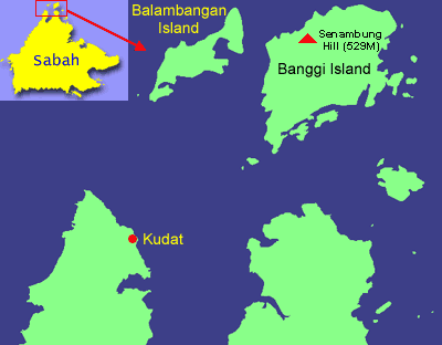
Pulau Balambangan (Balambangan Island) looks so big on Sabah map. However, very little is known about this island. The British East India Company built their first establishment in Sabah hundred years ago as a trading post. Unfortunately, it was attacked by Sulu pirates and British had to move their base to Kudat.
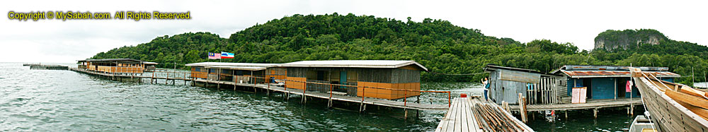
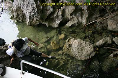
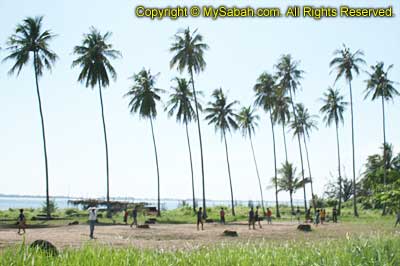
Someone call Balambangan Island a “Treasure Island,” as they believe there was an old Chinese/British ship, carried plenty of gold and other precious, was sunk by storm around this island but yet to be found. Anyway, I was not there for the treasure. I just want to document the caves, before they are gone. There are over 20 limestone caves on Balambangan Island and none of them is named, and only four are studied. I went to this island by following a boat departed from Banggi Island (Pulau Banggi), which is about 10KM away from this island. I stopped by Kg. Selamat (Selamat Village), which has abalone farming (at the left in photo below). Kg Selamat is not so “selamat” (safe) because sometimes you can find aggressive crocodiles swimming under the houses.
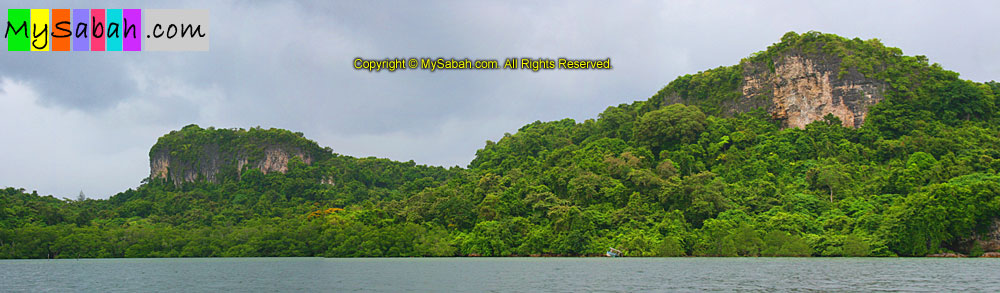
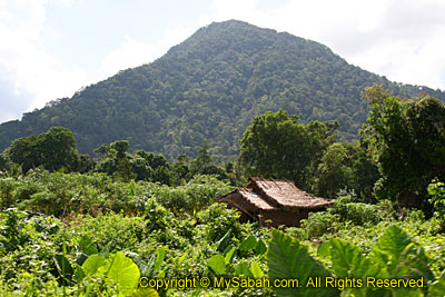
Talking about the salt-water crocodile, a local said the crocodiles were used to live in peace with the people here. One day, a fisherman caught some fishes and left them at the shore. When he came back, he saw a crocodile was eating his caught. In anger, he shot the crocodile. Probably the crocodiles also have “feeling”, so they started to attack the human. Some fishermen were eaten when they setup the fish trap in the water. Nevermind if you don’t believe this story. Below is a photo of limestone hills on the island.
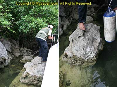
Then we proceeded to other side of the island, with mangrove area infested with crocodiles. Probably they all went to church on Sunday, so I didn’t see any of them around. There was no nice beach for landing, so I crossed the sharp limestones around the shore to get to land.
Click Here to see more photos of Balambangan Island >>
Click Here to see more photos of Balambangan Island >>
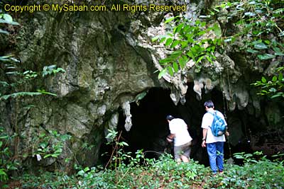
After a 10 minutes walk through a dense forest, I reached the limestone cave, where prehistoric human stayed here about 200,000 years ago. Archaeological findings from the Pleistocene era (the Ice Age - between 1.75 million to 11,000 years ago) was discovered in the cave of Balambangan Island. I also wonder if the Japanese had stationed here during the World War II, like the local mentioned.
Click Here to see more photos of Balambangan Island >>
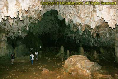
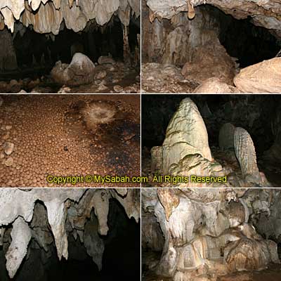
This cave is very big and deep. I saw many unique cave formations consisting of stalactites, stalagmites, flow stone and many other speleotems. I wished I could stay longer to see the art of nature that takes thousands years to form. I started taking photos like crazy, while others kept on yelling, “Hurry Up!! There were more stuffs here!” Busy, busy, busy…
Click Here to see more photos of Balambangan Island >>
There were many stalactites on top and stalagmites on the ground, making the cave looked like a big mouth of a monster with sharp teeth. You do not need to be a geologist to appreciate the beauty. These caves are not protected though they are considered as a natural and historic heritage. In the future, some developers would build a clinker plant to mine the limestone, the major raw ingredient of cement. So sad huh. It is like burning our house to keep ourselves warm.
Click Here to see more photos of Balambangan Island >>
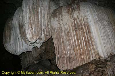
Some swiftlets and bats made noise to warn the “intruders”. The cave is dark and the floor is uneven, so I have to walk slowly. Otherwise I would step on a stalagmite that takes hundreds years to form (FYI, it grows only 0.5 inch every 100 years). The cave got a few tunnels that went very deep and narrow. None of us had the time and gut to explore the cave network. I also saw some ball-like “Cave Pearls” inside the stream of the cave. I shared over 50 photos in the album, so you can see more about the cave.
Click Here to see more photos of Balambangan Island >>
Undoubtedly, this cave is a promising spot as a geo-tourism attraction. Tip of Borneo is nothing if compared with it. To go to this island, you can hire a boat in Banggi Island, which will cost about RM200-300 (for day trip). Who knows you might find treasures in those unexplored caves.
Photos taken in Balambangan Island of Kudat, Sabah, Malaysia Borneo
Climbing Senambung Hill
April 25th, 2009
Bukit Senambung (Senambung Hill) is the highest point of Pulau Banggi (Banggi Island). This pyramid-shape hill is covered with dense forest and its top offers an irresistible aerial view of whole Pulau Banggi, so you will get both climbing + jungle trekking experiences.
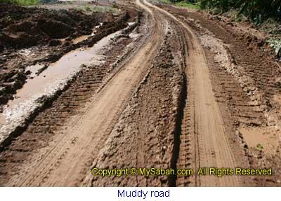
Bukit Senambung is located in Kalangkaman, about an hour drive from Karakit. It is advisable to use 4-wheel to run on this bumpy gravel path full of mud.
Click Here to see more photos of Bukit Senambung >>
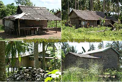
You know you enter a very remote area when you see many Dusun Bonggi huts, which are made of wood and dry leaves, along the way. These are probably one of the few places you can see such primitive houses in Sabah. My car is probably the only vehicle on the road, and my camera caught a lot of dust while shooting. There are hundreds of coconut trees that seem like the primary crop of the locals.
Click Here to see more photos of Senambung Hill >>
Senambung Hill is a class II forest reserve (commercial logging) managed by forestry department. The hill doesn’t look tall and steep, but this is a wrong impression. As we moved closer, we felt that we were so small. My expectation of a leisure and easy hiking was definitely too much.
Click Here to see more photos of Bukit Senambung >>
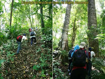
After registered with the ranger at the foothill, we started the climb. I was warned that the slope was quite steep and I should proceed cautiously and don’t try anything uncertain. The guide said we needed only 30 minutes to reach the top but we took over 2 hours!
Click Here to see more photos of Senambung Hill >>
Most of the time we were climbing the slope with a steep of about 40 to 70 degree. Though tired, there were cool breezes that made me felt much better. I saw only one small leech on the way. Well, it will be very minor problem to bother with, when you feel so exhausted. Only one person was bitten.

Click Here to see more photos of Bukit Senambung >>
The trail was slippery, muddy and not tourist-friendly. Forget about your hundred dollar branded shoes such as Timberland and Camel, as they are not as good as a pair of RM7 (USD$2) “Kampung Addidas” (Village Addidas), a local made rubber shoe. The expensive hiking shoe is prone to catching mud, and it will become a “skiing shoe” in such trail condition. The worst thing was - I brought a fragile camera, so I had to walk like a pregnant woman. A walking stick can make a difference too.
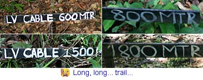
Most already started to feel the body stress after 500 Meters, and we didn’t know how long was the trail ahead. To maintain my determination, I didn’t dare to look up. I only focused on the part in front, walked and climbed slowly. I thought the trail was only 1KM and it was a 1.8KM. I could see the beautiful blue sea through the trees. That motivated me to move on.
Click Here to see more photos of Senambung Hill >>
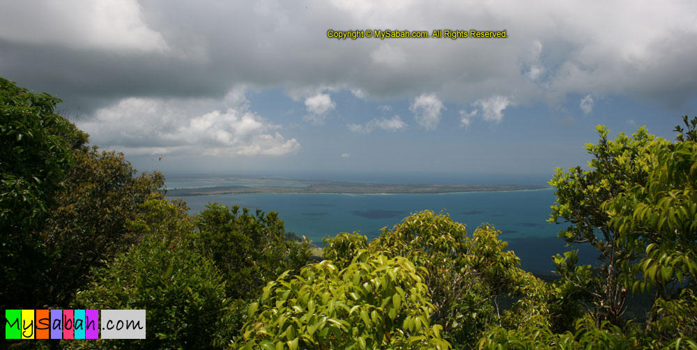
“Why still hasn’t arrived? How far are we?” we kept on asking the guides. I brought two small bottles of water and one 100Plus (which helped a lot!), and a few energy bar. I finished all of them. Finally, I was so glad I made it to the top. “Is it the top?” I asked the guide, as if it was hard to believe that the hardship was over. I was rewarded a nice view from the top.
^dGJ$82^%&2XYZ…!!! Why they call Bukit Senambung a “Hill”? Senambung Hill is 529 Meters high so it needs another 71 Meters to qualify as a Mountain (600M), in UK standard. However, it is considered as a Mountain under USA standard (1,000 feet). Whatever, I am happy to reach the top of it.
Photos taken in Banggi Island of Kudat, Sabah, Malaysia Borneo